| Web Mapping: Part 1 | Web Mapping: Part 2 | Web Mapping: Part 3 |
|---|---|---|
| Double Click for Full Screen | Double Click for Full Screen | Double Click for Full Screen |
Geocoding Customers / Resolving Map Errors
Click Here to View Support Document
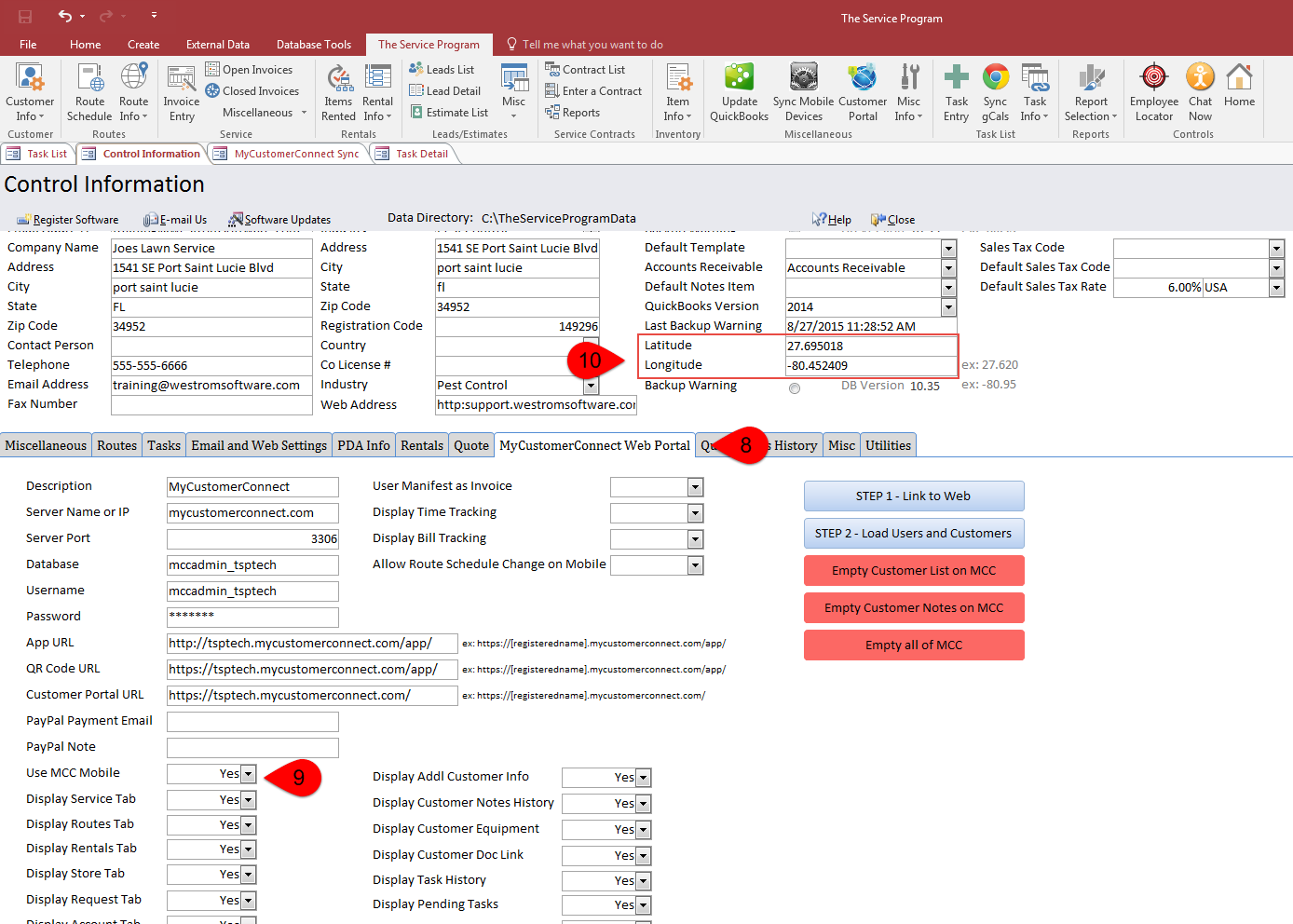
Control Table Settings
Before mapping, you will need to make sure your control table on the desktop has these settings:


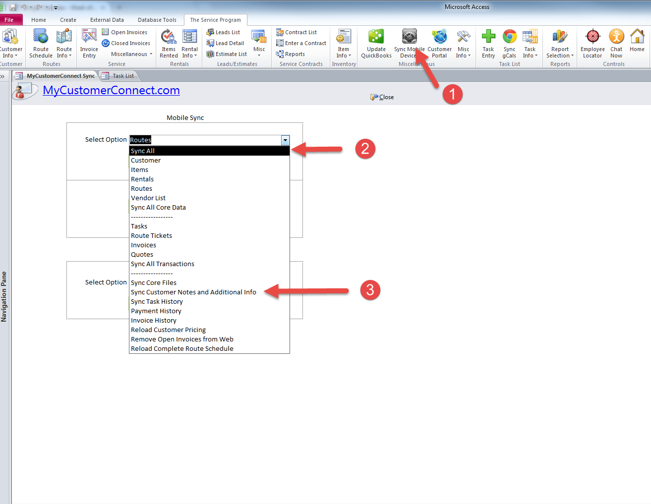
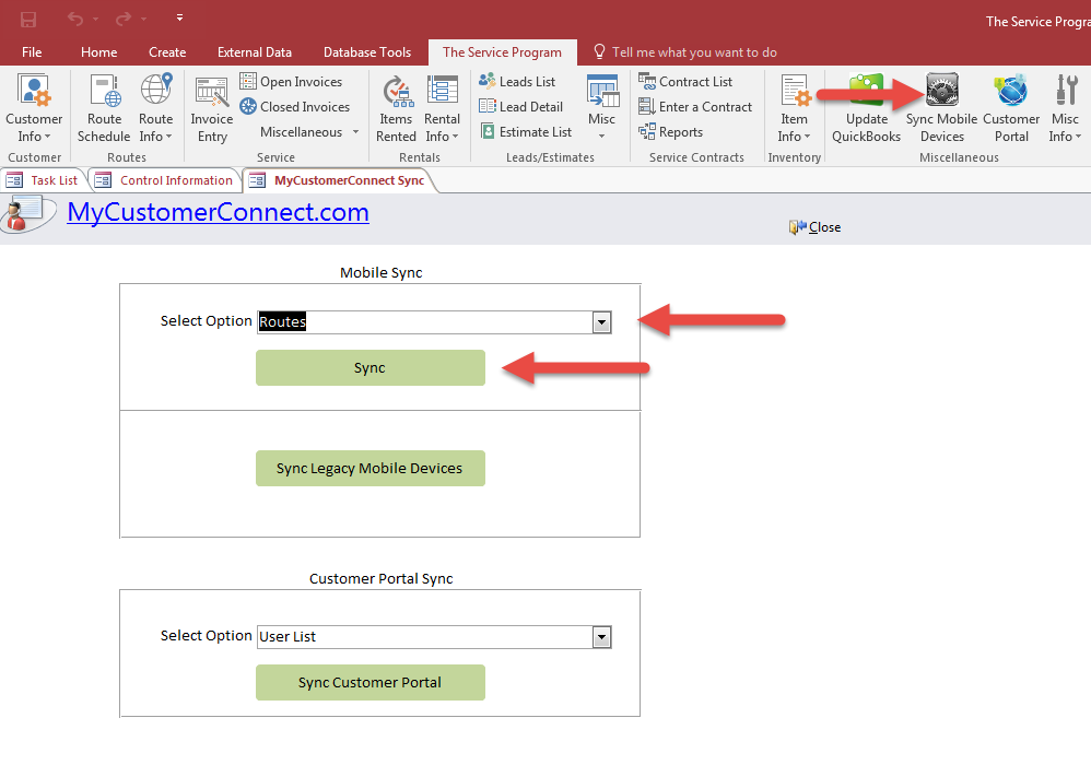
Syncing Desktop with Web Mapping
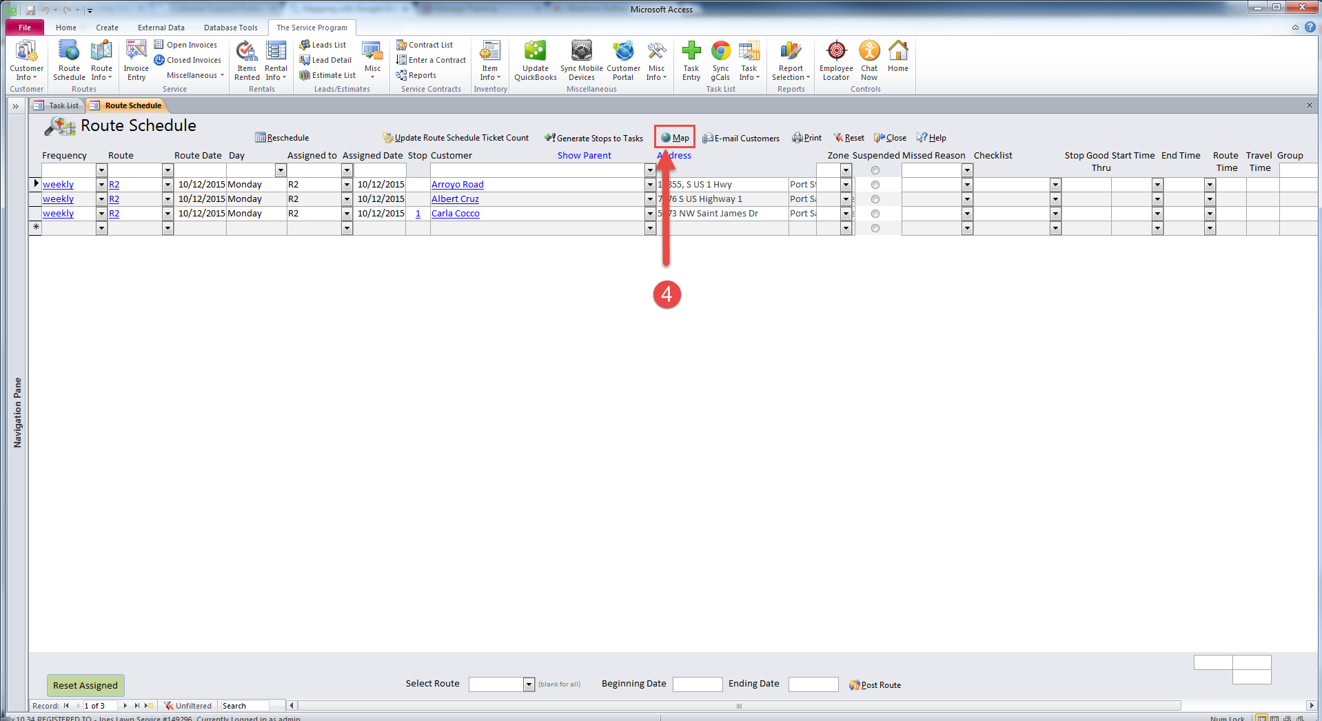
From the Sync Mobile Device Screen on the desktop, click Sync All, and then Sync Customer Notes and Additional Info. After the sync has completed, go to the route schedule and click Map
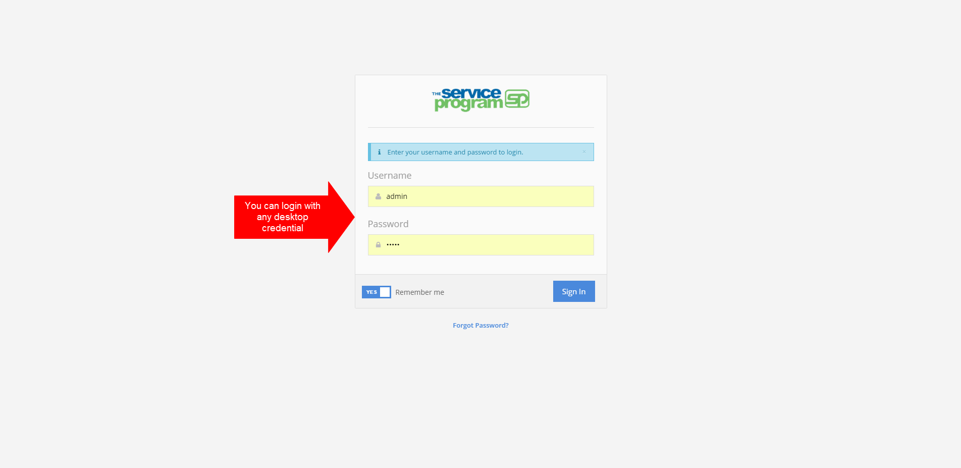
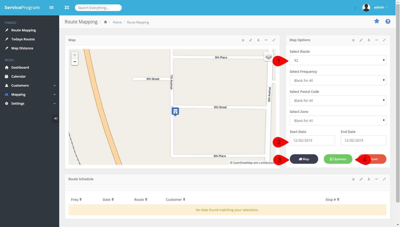
Now its time to Map your stops
Login with any desktop credential
Select your criteria under Map Options, and then click Map. You will see the map populate and beneath the map will be driving directions.
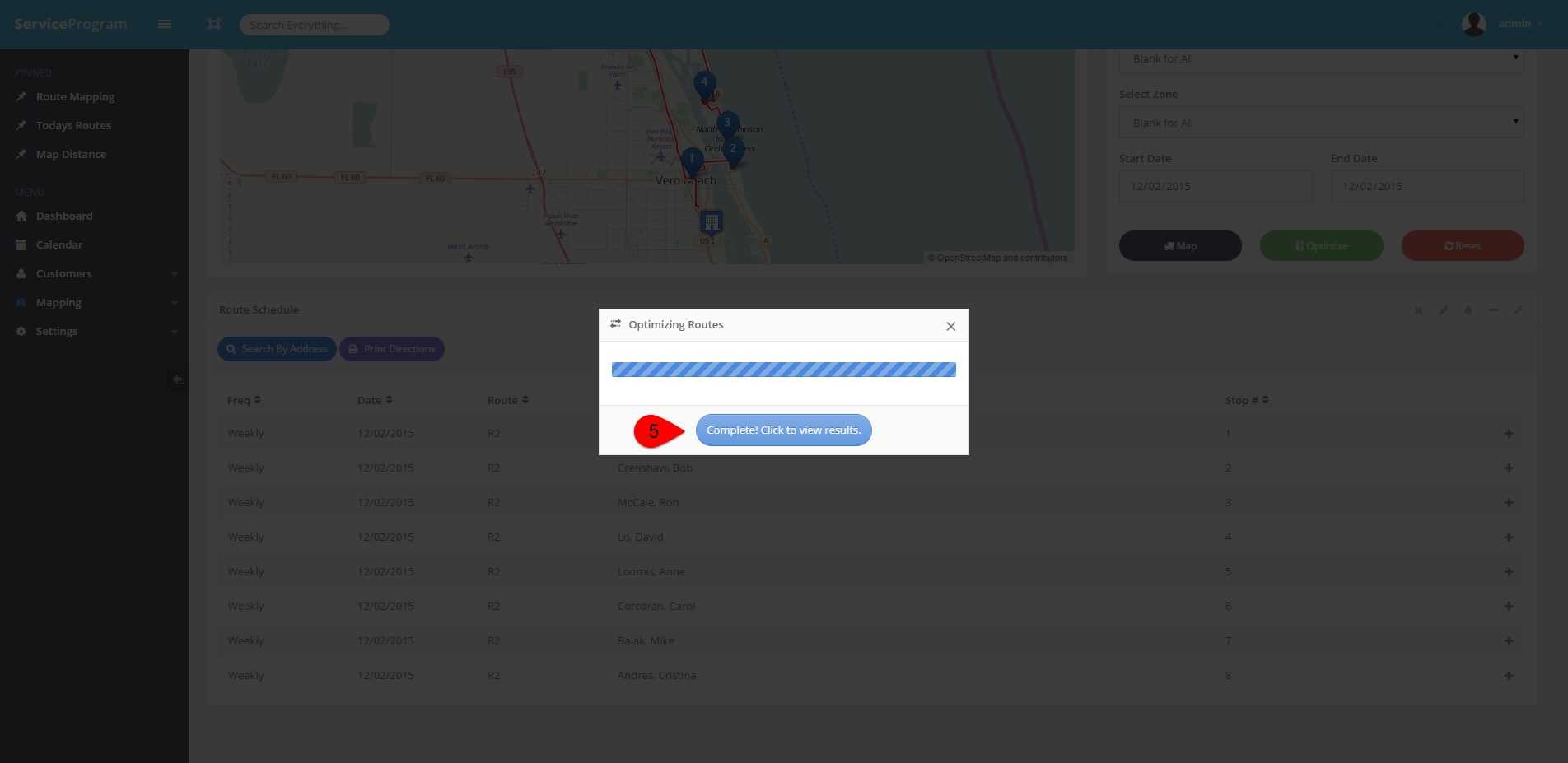
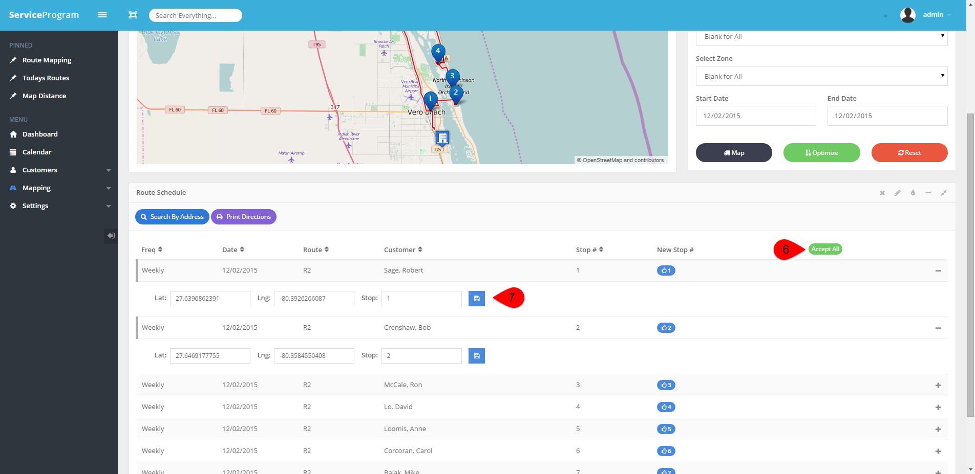
After you have mapped your stops, you can optimize the stops and have web mapping organize the stops for the best route it can find. You can then click on a stop to expand the details of the stop. It will display the latitude and the longitude for the stop as well as allow you to set your own stops numbers to tweak the route the way you like.
You can click Accept All, and / or you can expand the stop by clicking on it to enter in your own start numbers. Then click the disk to save
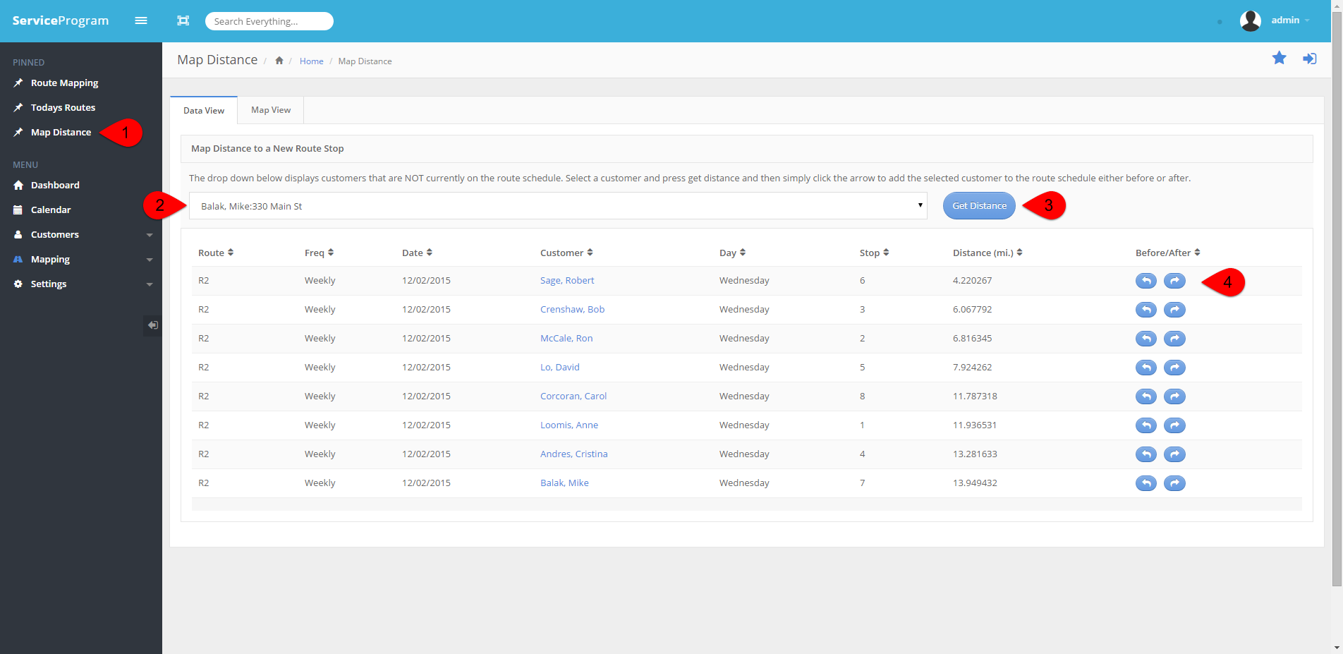
Mapping Distance for a New Route Stop
After you click Map Distance, you can choose a customer from the drop menu. The system will only display customers who are NOT on the route schedule. Then click Get Distance. The system will allow you to add the stop before or after the closest stop it finds, and will place that stop on the route schedule for you automatically.
Once you are done mapping, its time to bring your optimized stops back to the route schedule on the desktop. Click Sync Mobile Devices, and Sync Routes
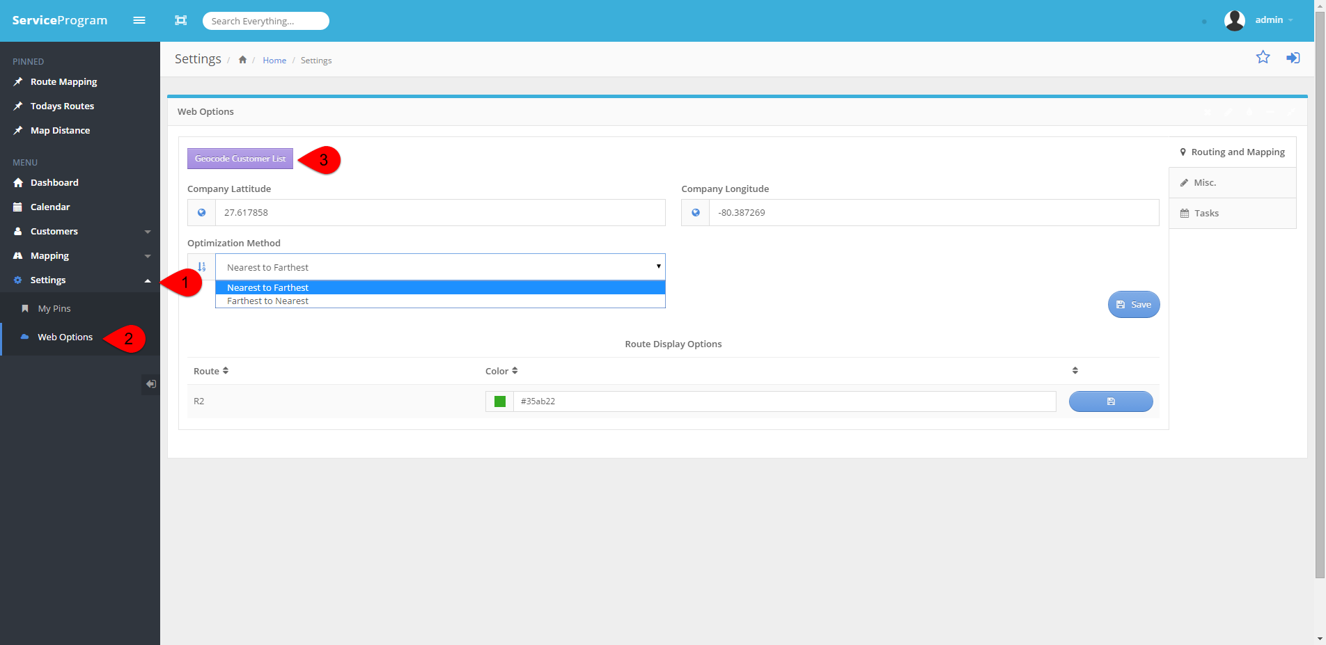
Geo-Locating your Customers
If you need to Geo-Locate your customers, you can do so by following these steps.
From the Web options screen, you can adjust your company latitude and longitude. You can also specify your optimization method. Setting this method will tell the system if you want the first stop be the farthest away (Farthest to Nearest) allowing your driver to work their way back to the office, or to have the first stop closer to the office (Nearest to Farthest).
Tech Note:
Our Web Mapping System is based on Open Source Routing Machine (OSRM); a implementation of a high-performance routing engine for shortest paths in road networks. It combines sophisticated routing algorithms with the open and free road network data of the Open Street Map (OSM) project. Shortest path computation on a continental sized network.
OSRM uses an implementation of Contraction Hierarchies and is able to compute and output a shortest path between any origin and destination within a few milliseconds, whereby the pure route computation takes much less time.